Culloden gives up some of its secrets
Share This Story, Choose Your Platform!
Culloden is one of the most iconic battles in Scotland’s bloody history, and one which holds a poignant place in the hearts and minds of Scots all overt the world.
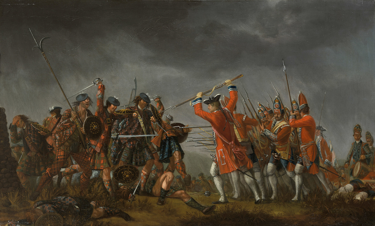
The Battle of Culloden
Now, more than 275 years after the slaughter, which lasted less than an hour and resulted in thousands of Jacobites being killed, wounded or captured, the site of the tragedy is still revealing its secrets.
Historic Environment Scotland (HES) has uncovered new evidence for the location of Culloden Parks, the designed landscape around Culloden House, which was an important element of the battlefield landscape in 1746.
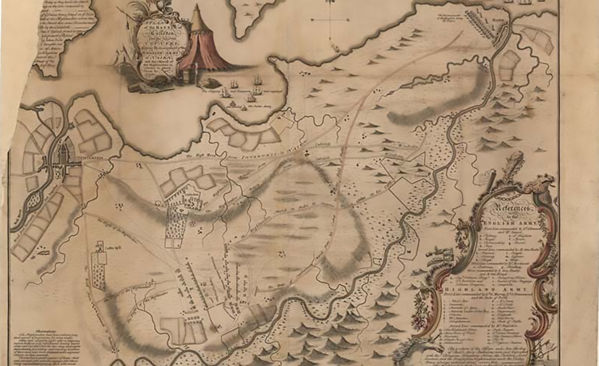
John Finlayson's map of the battle of Culloden and surrounding landscape. Maps reproduced with the permission of the National Library of Scotland CC BY 4.0
Culloden House played a key role in the conflict as a headquarters for Bonnie Prince Charlie and his Jacobite commanders in the days leading up to the battle.
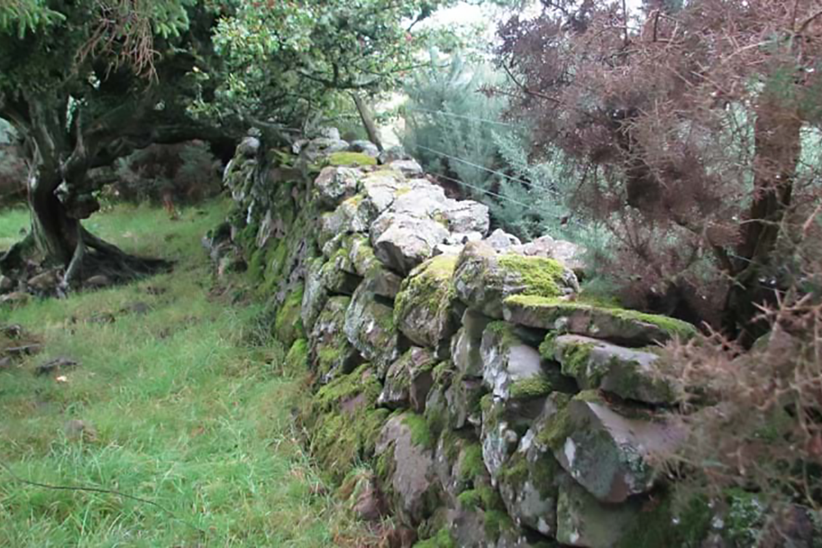
The investigation by HES has not only discovered new evidence which shows that Culloden Parks was situated further to the west of the traditional battlefield site than previously thought, but also that a significant amount of the boundary walls of the Parks survive.
This finding has a significant bearing on current understanding of the battlefield landscape and the battle itself. The Jacobites used the southern end of Culloden Parks as their left flank when they deployed for the battle, meaning the Jacobite left flank must also have occupied a more westerly position than was previously believed.
Culloden battlefield is one of the most visited tourist sites in the Highlands, and it holds a particularly high significance and emotional connection to many within Scotland and to their ancestors around the world.
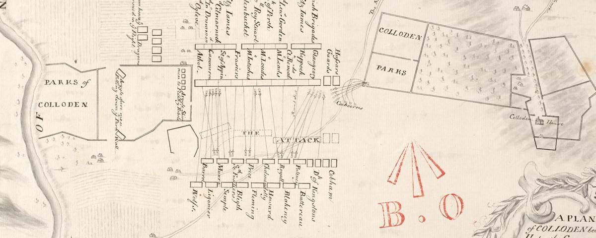
Imaged HES
The discovery of the location of Culloden Parks in the modern landscape was made by cross-referencing contemporary 18th century maps alongside much more precisely detailed modern mapping. HES also used modern technology in the form of airborne laser scanning, known as LIDAR, which records the landscape in 3D. This data can show subtle landscape features more prominently than is often seen on the ground, and in this case was able to show that the original channel of the Red Burn, another feature of the battlefield landscape, is also located further west than the currently understood positions of the armies would suggest. Finally, a field assessment was carried out to trace the physical evidence of the surviving walls on the ground.
Kevin Munro, Senior Designations Officer at HES who conducted the research, said: “The Battle of Culloden is one of the most documented and studied conflicts in Scotland’s history, so to unearth new information that will further enhance our understanding of this significant battle is very gratifying”.
"This clear evidence for the survival of Culloden Parks shows us that the story of the Battle of Culloden is still unfolding along with our understanding of the historic landscape. This research will further enhance our knowledge of the pivotal events that took place on 16 April 1746.”
